The Land of Springs
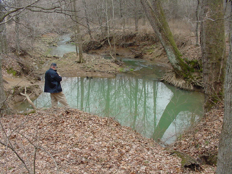
 Here I am recording information about the spring that is the source for Drake’s Creek in Hardin County, Kentucky. This is a spring of the artesian type, boiling up to form a “blue hole” spring
Kentucky is a land of springs. There are thousands of springs dotted across the state, from seeps and trickles to roaring torrents bursting from openings in the bedrock. Most of these springs, and particularly the larger ones, are located in the limestone country of the state. A little more than half of Kentucky has limestone bedrock at or near the surface, and the nature of this rock produces a distinctive type of landscape known as karst. This type of landscape develops as a result of the gradual dissolution of the bedrock by mildly acidic groundwater. The defining features of a karst landscape are sinkholes, sinking streams, and networks of enlarged conduits constituting groundwater flow systems.
Carbon dioxide and water vapor combine in the atmosphere to form carbonic acid, H2CO3, which is carried to earth in solution in precipitation. This acid is present everywhere in the natural waters of the planet, and can also be found, for example, in carbonated soft drinks, the result of the combination of carbon dioxide with the water in the soda. At the surface, acidic rainfall infiltrates into the soil, absorbing additional carbon dioxide from the organic matter as it percolates downward and enhancing its acidity. Upon contacting limestone, the acidic water moves laterally along the soil-bedrock interface until it encounters vertical crevices and descends into the bedrock. Most of these fissures carry water downward without showing signs of this activity at the surface, providing diffuse inputs into a groundwater flow system. Some are gradually enlarged as the rock dissolves, the overlying soil gradually migrating downward to create an enlarging sinkhole. If the sinkhole is intercepted by a surface stream, this becomes a sinking stream that plunges directly into the groundwater flow system.
Groundwater continues to move downward through fractures and crevices until it encounters a resistant rock layer such as shale, becoming “perched” on the unit, and flows laterally through bedrock partings, dissolving the bedrock to create a network of horizontal flow conduits. If the flow system has an external opening and conduits large enough for persons to traverse, this is termed a cave. Points where groundwater discharges to the surface are springs. These are of two basic types: gravity springs, which emerge from hillsides and flow down slope, and artesian springs, which are fed by water that rises from depth under pressure, often forming a circular pool. Springs that discharge at the level of the surface stream into which it flows are base-level springs. Other springs may be perched by insoluble rocks, guided to discharge from hillsides well above local stream levels. These generally drain smaller areas and have a lower flow volume than base-level springs.
As local base level is lowered by deepening stream and river valleys, groundwater flow develops new pathways at lower elevations and older conduits are abandoned. Reduction of the land surface by weathering and erosion gradually diminishes the thickness of the carbonate rock overlying those conduits nearest the surface, weakening its structural integrity. During this process, cavern passages are breached through sinkhole subsidence, collapse, and the widening of valleys. Cave entrances appear and are buried, high-level springs diminish and dry up, and new springs appear lower in the topography. Ultimately, through the millennia, karst conduit systems develop in sequence and are destroyed as the rock in which they occur is removed, until the given carbonate rock unit is entirely eliminated.
The natural processes at work in a karst landscape are also influenced by human activity, often to considerable extent. This is particularly true in urban karst, where the landscape may be deliberately and profoundly altered as the community develops. Springs, once cherished as water-supply sources, may be filled in or the flow diverted through storm drains so that the land may be used for other purposes. Sinkholes and cave entrances are covered to provide level land for development. In rural areas, springs tend to retain value as water sources for livestock and are thus usually preserved, though often modified with protective enclosures, retention basins, artificial channels, mill dams, and other structures intended to provide greater utility of the resource. Steep-sided sinkholes in the rural landscape are typically viewed as unusable land, since they cannot be farmed nor grazed, and often end up as dump sites for farm and household waste or fill materials. Alterations made to springs and sinkholes may disturb the natural drainage, surface and subsurface, to such an extent that flow pathways in the conduit network are rerouted, breaking out as new springs in unpredictable locations or accelerating new sinkhole development through collapse or subsidence.
I have been fascinated by springs since I was a young teen, although that is a story for another posting. Over the years I have visited, documented and photographed more than 700 springs in Kentucky, and carried out many dye-traces to establish relationships between springs and local karst flow systems. Along the way, I also became very interested in the types of modifications that people have built in order to utilize springs, ranging from simple enclosures to elaborate, multi-room and multi-story springhouses.
NEXT POST: SPRINGS AND PIONEER SETTLEMENT

