Caves and Karst
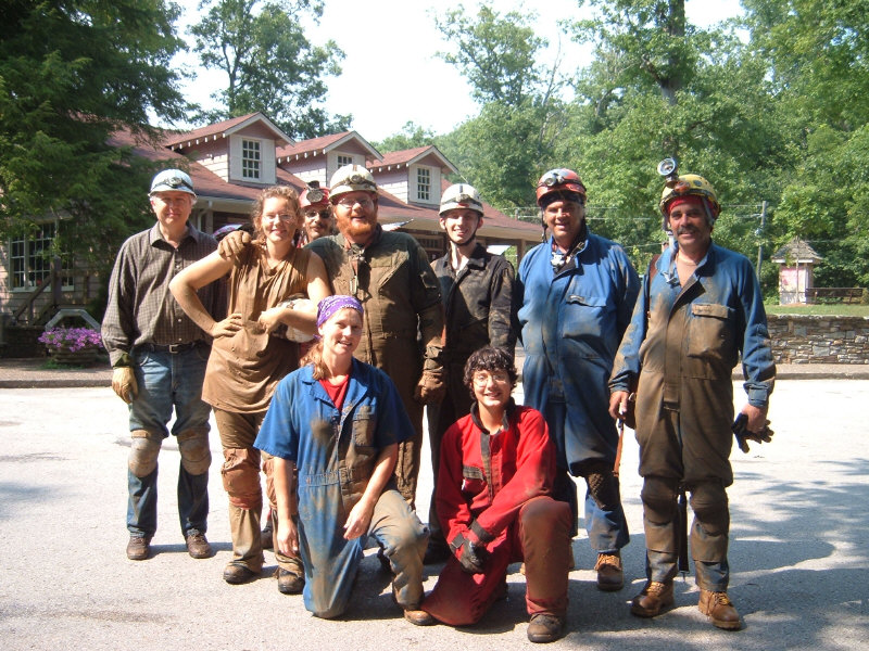
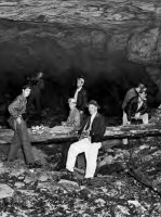
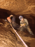
at Carter Caves State Park, Kentucky, 2007. Gary O’Dell is second from right, standing.
“Blue Grass Grotto: The First Ten Years.” The Kentucky Caver 58 (Summer 2023), 1-63. Founded in 1862 by biologists of the University of Kentucky and their graduate students, the Blue Grass Grotto (chapter) of the National Speleological Society was for many years oriented toward cave science and system projects more than recreational caving. This history of the early years focuses on significant persons, events, and caving activities associated with the new organization.
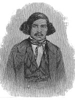
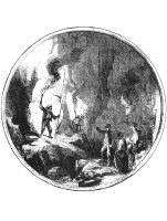
“Stephen Bishop: The Celebrated Guide of Mammoth Cave,” Register of the Kentucky Historical Society 120 (Spring 2022): 99-143. Stephen Bishop is considered by many to be the greatest cave explorer of all time. An enslaved man, he was the most famous guide at Mammoth Cave during the antebellum period, whose daring exploits, personal magnetism, and knowledgeable discourses on the science of caves brought him international celebrity. This article provides insights on the early life of Bishop.
“Johnny Depp’s Secret Cave.” NSS News (National Speleological Society) 79 (March 2021): 6-10. Permission was obtained by the author to reopen and explore this small cave on the property of actor Johnny Depp in Lexington, Kentucky.
“Willard Rouse Jillson and the Crystal Cave of Sloans Valley, Kentucky.” NSS News 77 (August 2019): 12-24. With nearly 25 miles of mapped passage, Sloans Valley is one of the longest caves in the world. A section of the cave, known as Crystal Cave, was exhibited as a show cave from 1934 to 1951. In 1950, the erection of Wolf Creek Dam, which would impound Lake Cumberland and flood much of the cave system, spurred geologist Willard Rouse Jillson to undertake a survey of Crystal Cave with the aid of his students from Transylvania University in Lexington. Drawing on Jillson’s published account and unpublished student papers, this article provides a detailed account of the Jillson project, and discusses the more recent mapping efforts which led to Sloan’s world-class status.
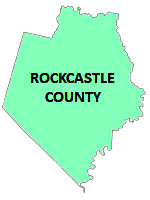
“William H. Russell (1937-2019): A Rockcastle Pioneer.” RKC Newsletter (Spring, 2019), 7. Rockcastle Karst Conservancy. During the early 1960s, the late Bill Russell, a well-known Texas caver, was the first person to survey many of the major caves in Rockcastle County, Kentucky.
“The Celebrated Black Explorer Stephen Bishop and Mammoth Cave: Observations by an English Journalist in 1853,” NSS News (National Speleological Society), 76 (September, 2018): 4-18. This article provides a first-hand account of the Mammoth Cave tourist experience and of Stephen Bishop, the famous cave guide and explorer
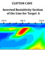
“Locating a Sealed Cave in Kentucky Using Electrical Resistivity Surveys.” AIMS Geosciences 2 (1, 2016): 32-44. Co-authored with Zhu, J, E.L. Laudermilk, G. Bogosian, J.C. Currens, S.E. Webb, and P. Bogosian. The entrance to Clifton Cave in Woodford County, Kentucky, home to two rare cave invertebrates, was destroyed by highway construction in 1970. This project used electrical resistivity to located voids representing passages in the cave with the aim to reestablish an entrance via borehole.
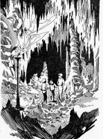
“Fair and Square: Robert F. Schulkers, Seckatary Hawkins and the Literature of an Ohio Valley Childhood.” Ohio Valley History 15(Fall, 2015): 43-67. With G. Bogosian. Robert F. Schulkers wrote serialized adventure stories for children in newspapers during the first half of the twentieth century. The popularity of these stories spawned a national club similar in scale to the Mickey Mouse Club or Boy Scouts. The stories were also assembled into book form. A vast fictional cave system featured in many of these tales.
“Seckatary Hawkins and Cliff(ton) Cave: The Underground Adventures of Robert F. Schulkers.” NSS News (National Speleological Society) 72 (July, 2014): 10-20. With G. Bogosian. Robert F. Schulkers, who wrote serialized adventure stories for children during the first half of the twentieth century, featured a vast fictional cave system in many of his tales. The use of caves as plot devices appears to have been inspired by his visits to Clifton Cave in Woodford County and Daniel Boone Cave in Jessamine County, a former show cave.
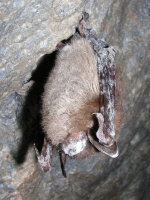
“Cavers React to the Spread of White Nose Syndrome: A Survey.” NSS News 69 (August, 2011):4-10. With Tim Engle. White Nose Syndrome, a fungal disease often fatal to bats, began spreading in the United States in 2006 and resulted in the death of millions of bats. In the belief that human visitation was spreading the disease, many land management agencies closed caves to visitors. This article reports the results of a study concerning the self-reported attitudes and behavior of National Speleological Society members in response to the outbreak and the cave closures.
“Going Underground: A Field Investigation and Lab Activity on Karst Topography and Water Systems,” The Science Teacher 78 (December, 2011): 53-57. With Wilson Gonsalez-Espada. This article presents simple lab and field exercises involving dye-tracing to acquaint secondary-school students with concepts of groundwater flow in karst systems.
“Using Historical Archives to Discover Forgotten Caves,” Journal of Spelean History 42 (July-Dec, 2008): 18-29. This article explains how information archived in diaries, personal correspondence, popular and scientific journals, newspaper items and other sources can be referenced to discover clues as to caves whose existence or locations are presently unknown.
“Caves & Karst.” In Clark’s Kentucky Almanac 2006 Lexington, KY: Clark Group, 2006), 329-330. A brief essay on the processes of cave formation and the various karst regions of Kentucky, intended for the general public.
“Cave Exploration.” In Clark’s Kentucky Almanac 2006 (Lexington, KY: Clark Group, 2006), 643-644. A brief discussion of cave exploration intended for the general public, emphasizing the basic safety rules and the fragility of the cavern environment.
Investigation of Laura Spring in the Raven Run Watershed, Fayette County, Kentucky. Unpublished white paper, 1998, Groundwater Branch, Kentucky Division of Water. A report on field investigation and dye traces conducted to determine groundwater flow patterns in part of Raven Run, a tributary of the Kentucky River in Fayette County entrenched in a gorge 300 feet below the surrounding peneplain.
“Subterranean Explorers: Mapping Russell Cave with GPS and Magnetic Induction Radio.” GPS World (October, 1996): 20-33. With R. Householder and F. Reid. Over a mile in length, Russell Cave is the longest cave in Fayette County, Kentucky, and has a well-documented history going back more than 200 years. It is a major groundwater system in the northern part of the county, with a large stream flowing throughout the cave, and is frequently subject to flooding. Because the accuracy of cave surveys tends to degrade with distance from the starting point, an experiment was made to determine if accuracy could be improved using magnetic induction technology (“cave radio”) to pinpoint locations within the cave on the surface to allow correction of the plotted survey using GPS. The project, using simultaneous caving and surface teams, was the first to combine these technologies and was successful in producing a more accurate cave map.
“The Rescue of McConnell Springs Historic Site: A Partnership Between Local Government and the Citizens of Lexington, Kentucky.” In Proceedings, 1995 Cave Management Symposium, ed. G.T. Rea, (Indianapolis: Indiana Karst Conservancy, 1996): 255-266. With J. Rebmann. McConnell Springs is a series of rises and sinks located within the urban area of Lexington, representing a unique oasis of greenery surrounded by industrial and suburban development. The location is historically significant as the site of a 1775 explorers’ camp where the name for the future community of Lexington was proposed. During the War of 1812 and for twenty years afterward this was the location of the largest gunpowder mill in Kentucky, and later a distillery. In 1985 the property was purchased by a developer who intended to turn the entire site into an industrial park, and violated local ordinances regarding dumping and grading around sinkholes. Legal action stopped the developer, and through public interest the site was acquired and incorporated into the city park system.
Karst Groundwater Issues Related to U.S. Forest Service Management Practices in the Daniel Boone National Forest, Kentucky, With Specific Focus on the Horse Lick Creek Ecosystem. Unpublished paper presented at a 1994 meeting of Permanent Horse Lick Ecosystem Management Analysis Team, Berea, Kentucky. Horse Lick Creek in Jackson County, Kentucky, is one of the most biologically diverse watershed ecosystems in the state. Much of the system is located on property of the U.S. Forest Service. Activities on USFS land related to timber production and harvesting have the potential to impact surface and groundwater quality. This paper makes recommendations to minimize such impacts.
“Cave Spring Farm: Karst Springs and the Settlement of Kentucky.” NSS News 51 (December, 1993): 323-327. The pioneers who came to Kentucky in the late 18th century used two important criteria to select land for their claims: the fertility of the soil and the presence of a spring suitable for a water supply. This article presents a case study of the historic site known as Cave Spring Farm, location of Boggs Cave, a low bedding-plane crawlway about 1,000 feet long from which a significant spring discharges. A large tract of 1,000 acres surrounding the spring was claimed in 1775 and subsequently settled by Robert Boggs. The spring served as the water supply for many generations of the Boggs family, and although superseded by “city” water in 1964. The property remains in the hands of Boggs descendants in the present day.
“Samuel M. Cassidy, Jr., 1902-1992.” Obituary. NSS News 51(September, 1993): 249. The late Samuel M. Cassidy was a descendant of Robert Boggs and owner of Cave Spring Farm and Boggs Cave at the time of his death. Although not a cave explorer, he was a good friend to cavers and joined the Blue Grass Grotto, contributing an article on the history of Boggs Cave to The Kentucky Caver and passing along issues a young friend in Tennessee who was “getting the fever.”
“Rockcastle’s Underground Wilderness.” In Rockcastle County, Kentucky, and its People. (Waynesville, NC: Don Mills, 1992): 48-49. This is a brief description of the cave region of Rockcastle County and summary history of cave exploration here, written for a general audience.
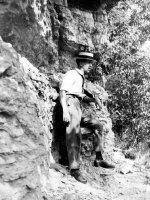
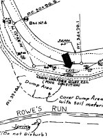
“The Obliteration of Clifton Cave.” Journal of Spelean History 24 (July-Sept, 1990): 4-9. I first visited Clifton Cave in Woodford County in 1968 as a young caver on a Blue Grass Grotto (NSS) field trip. The cave had been surveyed to about 1,800 feet. When I was again in the neighborhood, I was astonished to discover that ongoing road widening had destroyed and buried the entrance and possibly some of the passages in the cave, leaving only a few small remnants visible in the new roadcut.
“Slacks Cave Bicentennial, 1790-1990.” NSS News 48 (March, 1990): 60-63. With L.E. Spangler. Slack’s Cave, surveyed by the Blue Grass Grotto in 1964 to a length of 7,185 feet, is the second-longest cave in the Bluegrass. A brief newspaper account published in June, 1790, is identified as describing this cave and constitutes the oldest published description of a Kentucky cave.
“Phelps Cave.” NSS News 47 (December, 1989): 296-299. Phelps Cave, located in southwest Lexington, is one of the more historic caves of the region with a number of interesting human-built features. Previous to 1921, only about half of the present-day cave was known, but in that year a boy living on the farm dug through into a new section, bringing the total length to about 1,500 feet. The old passage once connected with a second entrance, long-covered, and a crude iron gate is present at the opening to a stoopway passage filled with rockfall and debris that once led to this entrance. Further back, a floor-to-ceiling stone wall was built across the width of the passage, with a doorway allowing entry through it. These constructions date from the 19th century and historic tradition holds that these were associated with the “Underground Railroad” of the slavery era, although this seems unlikely.
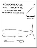
“The Obituary of Picadome Cave.” Journal of Spelean History 22 (Oct-Dec, 1988): 7-12. Picadome Cave is a short cave located in south Lexington just off Harrodsburg Road, and was one of the best-known and frequently visited caves in the city before it was sealed in 1957. It was especially popular with children from the nearby Picadome Elementary School, and fears for their safety led to its closure.
“History and Description of Russell Cave.” Journal of Spelean History 19 (3, 1985): 64-73. Russell Cave, over 5,000 feet long but very wet, has long been one of the best-known caves near Lexington, with a long rich history of visitation. A detailed account of exploration was published in 1820, the visitors having fortified themselves with brandy and using candles for lighting. The locale above the cave was a popular spot for picnics and political rallies. In 1944, a local youth was killed by rockfall in the cave, and the cave has generally remained closed to most visitors since.
“Underground Discoveries Reveal Kentucky’s Past.” NSS News 43(July, 1985): 231-233. The article describes paleontological discoveries that have been made in caves near Lexington.

